 |
WAITING FOR THE
SHADOW
SOLAR AND LUNAR ECLIPSE OBSERVINGHOME PAGE |
|
|
| Introduction | Sun/ Moon Rise/ Set |
Sun Altitude Eclipse Day |
Orientation- corona Sun's axis EQ mount alignment |
Sky at totality | Photographic Information | Power & Batteries | Further reading |
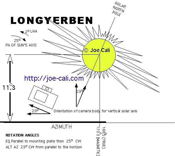
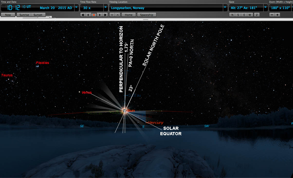
The two diagrams show the orientation of the corona
with respect to the local horizon at Longyearbyen during
totality. Both diagrams take rotation of the Earth and tilt
of the sun's axis into account. [Source :Joe Cali]  |
 Source Starry night Pro 6. Extra graphics, axis lines and labels added by Joe Cali in Photoshop. |
 |
Magnetic Declination Longyerben D, the magnetic declination (sometimes called the magnetic variation), is the angle between the horizontal component of the magnetic field and true north. It is positive when the compass points east of true north, and negative when the compass points west of true north. Declination is given in degrees and its annual change is in degrees per year. The value of magnetic declination should be added to a magnetic compass bearing to yield the true north bearing. Latitude 78.25o N Longitude 15.63o E Magnetic declination Australian Geomagnetic Reference Field Computation Requested: Latitude 78o 15' 00", Longitude 15o 40' 00", Elevation 100 km, Date 2014/03/20 Calculated: Latitude +78.2500o, Longitude +15.6667o, Elevation 100.00 km, Epoch 2014.2137 Location is outside the AGRF area. A global field model has been used. Magnetic Field Components Date is outside global field model limits. Above application does not extend to 2015. An extrapolation (below) has been calculated and applied by Joe Cali. D=0.2999*YEAR-597.47 = (0.2999 x 2015)-597.47 = + 6.828o Magnetic declination = +6.828o Magnetic north is 6.828o east of true north Source http://ga.gov.au |

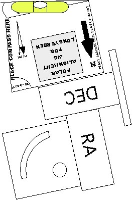
Using the jig and a compass to set the azimuth of the polar axis. The jig takes the compass away from magnetic metals and components in the mount and applies the magnetic declination correction to point the polar axis true north.  |
Using the jig and a compass to set the altitude of the polar axis.
A simple line level attached to the jig using double sided tape is  |